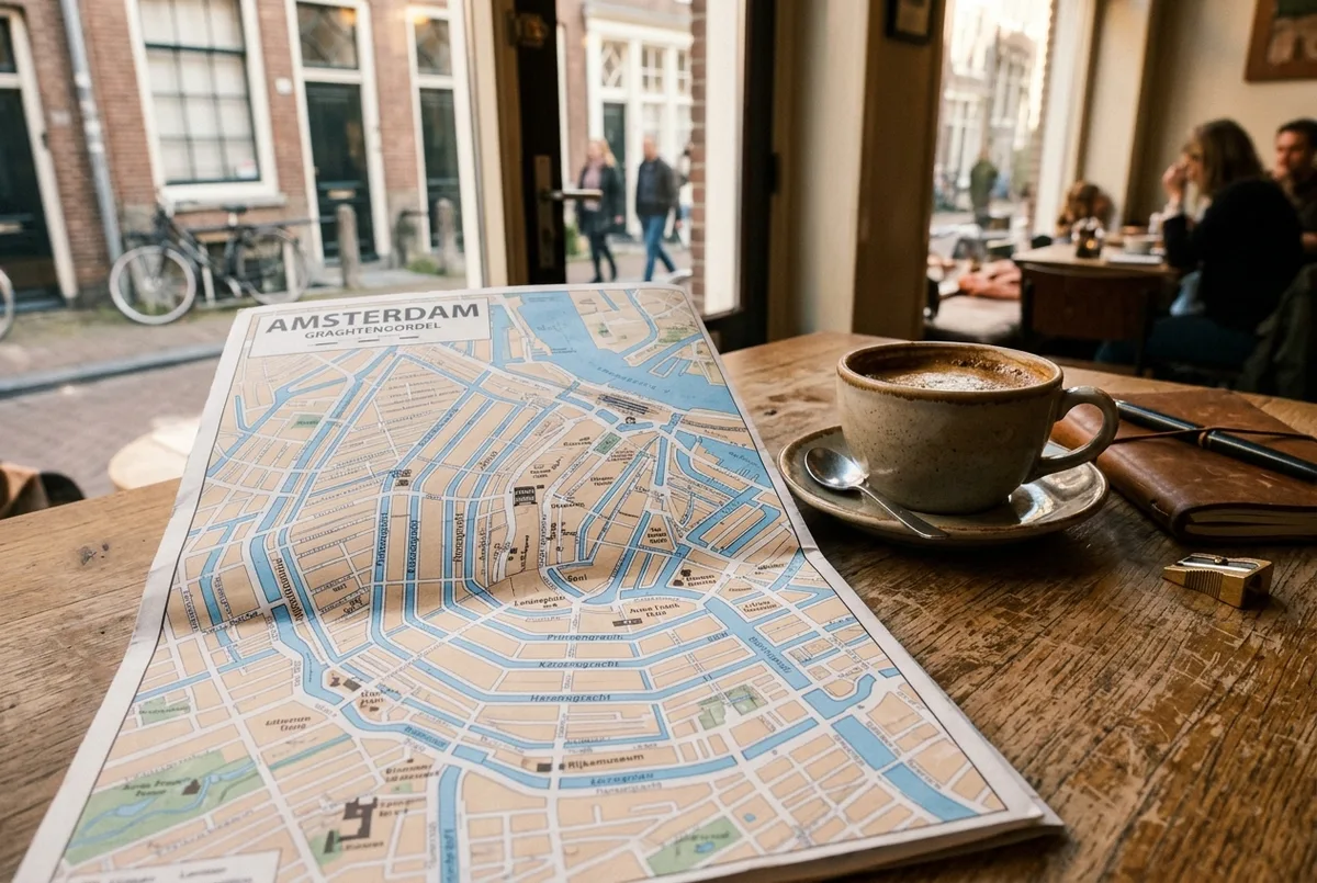
A map of amsterdam looks chaotic the first time you open one, and then it clicks: the city centre is a horseshoe. Centraal Station sits at the top, four big canals curve away from it to the south, and the old centre fills the space inside them. Once you hold that one shape in your head, every street name and tram stop stops being random. This guide walks through the layout the way I would explain it to a friend on their first morning: what is inside the ring, what sits just outside it, and how long it actually takes to walk between the places you came to see.
What Shape Is Amsterdam, Really?
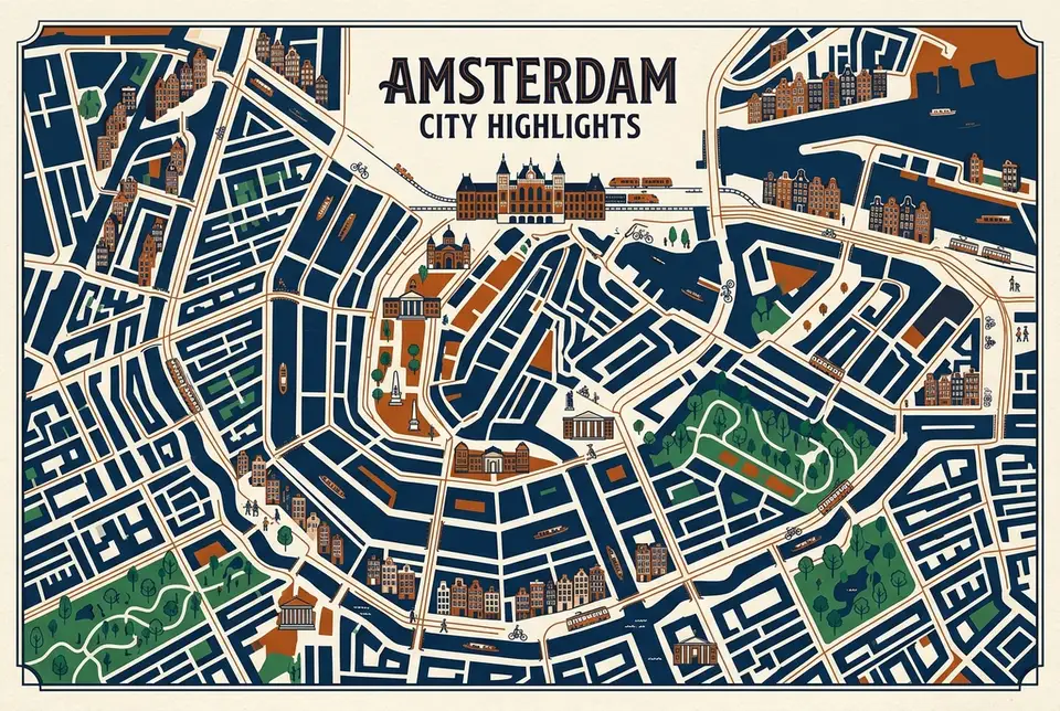
Picture a horseshoe lying on its side with the open end pointing north toward the water. Centraal Station sits at that opening. Four canals run in parallel arcs around the centre: Singel closest in, then Herengracht, Keizersgracht, and Prinsengracht furthest out. Streets cross those arcs like spokes. If you know which canal you are standing on and which way the water curves, you know roughly where you are, which is why I would stop staring at a phone screen and look at the nearest canal sign instead.
Where Do You Actually Arrive?
Nearly everyone starts at Centraal Station, and that is useful, because it is the one fixed point every route in the city runs back to. Trains from Schiphol Airport reach it in under twenty minutes. Trams fan out from the front. Free GVB ferries leave from behind it, crossing the IJ to Amsterdam Noord in a few minutes. The hop-on hop-off bus and boat routes both use it as their main hub, which is covered in detail on my Amsterdam hop-on hop-off map and route guide if you want the stop-by-stop version rather than the city-wide one.
How Far Apart Are the Big Sights?
Closer than most people expect. Walk straight south from Centraal down Damrak and you reach Dam Square in about ten minutes. From Dam Square, the Anne Frank House on Prinsengracht is another fifteen minutes west, and Museumplein, where the Rijksmuseum and Van Gogh Museum sit side by side, is roughly thirty minutes southwest. That is the whole tourist core: an area you can cross end to end on foot in well under an hour. I would walk it on day one rather than ride, because the walking is how the map stops being abstract.
What Sits Inside the Canal Ring?
The oldest part of the city, and the densest concentration of what you probably came for. Dam Square and the Royal Palace sit in the middle. The Red Light District occupies the eastern side of the old centre, closer to the station than most visitors realise. The Nine Streets, the shopping lanes between Singel and Prinsengracht, cut across the western arc. The Bloemenmarkt flower stalls line the Singel on the southern edge. It is compact, it is busy, and it is the part where I would think twice about booking a hotel if you are a light sleeper.
What Sits Just Outside It?
This is the half of the map most first-timers ignore, and it is where the city gets pleasant. Jordaan lies immediately west of the ring: narrow streets, small bars, no big sights, which is exactly the point. De Pijp sits south, built around the Albert Cuyp Market, and the Heineken Experience stands on its northern edge, covered on my Heineken Experience tickets guide. Vondelpark stretches west of Museumplein. Amsterdam Noord is across the water, reached by that free ferry, and feels like a different city entirely.
Which Squares Anchor the South Edge?
Leidseplein and Rembrandtplein, and knowing them saves a lot of navigational confusion. Both sit on the southern rim of the canal ring, both are tram interchanges, and both are nightlife hubs. Leidseplein is the western one, near the entrance to Vondelpark. Rembrandtplein is the eastern one, a short walk from the Bloemenmarkt. If a set of directions tells you to change trams at a square whose name ends in “plein”, it almost certainly means one of these two.
How Do the Canals Help You Navigate?
They are the only landmarks that never move. The four ring canals always curve the same way, so if the water bends left as you face it, you are heading east around the arc, and if it bends right, you are heading west. The cross-canals cut straight through. I find this far more reliable than following street names, since Amsterdam streets change name every few blocks along the same stretch of pavement. Seeing the ring from water level makes the whole thing obvious in about twenty minutes, which is the real argument for a canal cruise on your first day rather than your last.
Is the Centre Walkable End to End?
Yes, and that is the single most useful fact on this page. The tourist core measures roughly two kilometres across. A reasonably paced walk from Centraal Station to Museumplein takes about half an hour without stops. What tires people out is not distance but cobbles, bridges, bikes and stopping every thirty seconds to photograph a gable. I would plan on foot for anything inside the ring and use transport for anything beyond it.
Where Does Public Transport Fit on the Map?
Trams are the workhorse and they radiate outward from Centraal like spokes, which means almost any journey between two outer neighbourhoods is faster if you accept a change in the centre. The metro is a small network built mainly for commuters, useful for the north-south run under the city and little else for visitors. Buses fill the gaps toward the outer districts. Fares and route planning sit with GVB, the city transport operator, and I would trust their journey planner over a generic map app.
Where Do the Sightseeing Routes Run?
Both the hop-on hop-off bus and the canal boat loop are designed around this same horseshoe, hitting Centraal, the museum quarter, and the western canals before curving back. That overlap is the point: the route is essentially a moving version of the map above. If you want the stop list, the frequencies and the honest verdict on whether it is worth the fare, my hop-on hop-off route guide and my is it worth it breakdown cover both sides of that question.
What Would I Do With This Map on Day One?
Walk south from Centraal to Dam Square, cut west into the Nine Streets, follow Prinsengracht past the Anne Frank House, then turn south toward Museumplein and finish in Vondelpark. That single line traces most of the horseshoe on foot in an afternoon, and it teaches you the layout better than any printed map will. After that, the trams and the sightseeing routes make immediate sense, because you already know which direction everything is in.
For trip planning beyond the geography, my Amsterdam travel guide covers what to prioritise, and the I amsterdam official visitor site keeps the current opening hours and event listings. If you are still deciding how long to stay, my how many days in Amsterdam guide works through that.
Want the layout explained while you ride it? The Amsterdam hop-on hop-off bus and boat ticket covers the same horseshoe from road and water with commentary, with free cancellation if plans change.
Frequently Asked Questions
How big is Amsterdam city centre?
The main tourist core is roughly two kilometres across. Walking from Centraal Station to Museumplein takes about thirty minutes at an easy pace.
What are the four main canals in Amsterdam?
From the centre outward: Singel, Herengracht, Keizersgracht and Prinsengracht. They curve in parallel arcs around the old city.
Is Amsterdam easy to navigate on foot?
Yes, once you understand the horseshoe shape. The canals curve consistently, so the direction the water bends tells you which way around the ring you are heading.
How do I get from Schiphol Airport into the centre?
Trains run to Centraal Station in under twenty minutes and cost a fraction of a taxi. It is the option I would take every time.
Which neighbourhoods are worth walking to outside the ring?
Jordaan to the west, De Pijp to the south, and Amsterdam Noord across the free ferry. All three are short trips from the centre and far quieter than the core.
amsterdam hop on hop off ticket comparison guide →